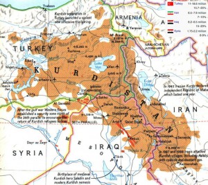
Lesser Syria, Greater Kurdistan, Armenia’s Mt. Olympus
Here in America it’s somewhat notable to meet up with someone who can identify all fifty of our states if presented with a national map that doesn’t have a legend. European weapons and European diseases made quick work of the native population and there are only a few areas where there is any political friction from the survivors, mostly remote places like Pine Ridge, South Dakota.

The ethnic, sectarian, and historical divisions of the Mideast are obscure and puzzling to us in general, and they remain puzzling to our policy makers. This is about expectations – the U.S. civil war was an anomaly. We had defined nation states, uniformed armies, a clear cut beginning, a fairly clean end, and while the meme has never died there hasn’t been any large scale violence since the cessation of the conflict, nearly 150 years ago. The Mideast is full and there are always tensions the likes of which we never experience here.
This being said, I am now going to put up a bunch of maps and engage in a bit of wild speculation about some things that aren’t all that likely to happen, but if they did … well … game changers.
Read rest of post with graphics.
When I wrote Mali Is Neither Afghanistan Nor Somalia in mid-January I was coming from a place of common sense. Mali does not have anything like Afghanistan’s opium poppy crop or Somalia’s piracy opportunities. The only shady business that goes on there is the keeping of western captives. It’s reported that half of all kidnap victims in all of Africa are kept somewhere in Azawad – the rebellious part of Mali north of the Niger river.
Economic Causes of Civil Conflict and their Implications for Policy, a 2006 paper on the analysis of 47 civil wars, provided a serious academic confirmation of what I had suspected – insurgencies without funding sources simply don’t last. What does this mean for Syria?


