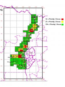
East View Cartographic, the single most extraordinary geospatial support service in the commercial sector, created the attached without color; the G-2 of United Nations Forces Eastern Congo prioritized their needs (the West still does not have 1:50,000 combat chart with contour line coverage for most of the Third World, i.e. the bulk of the ungovernable unstable zones). It was this single graphic that got the Dutch government to approve a US$3 million expenditure to meet the needs of UN forces in the Eastern Congo.
NOTE: Not a single map existed. Green above represents the least urgent, yellow and red the more urgent.


