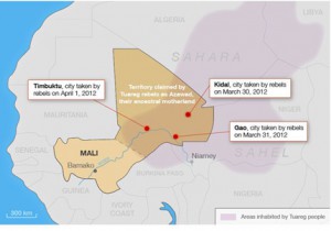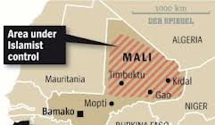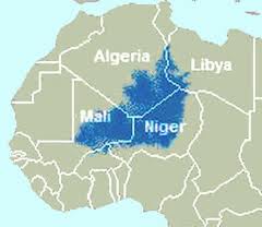
Click on Image to Enlarge
Algeria: The Algerian government has given tacit approval for an African-led military intervention in Mali so long as there are no troops stationed on Algerian soil.
Comment: This means that Algeria will try to help by sealing its border with Mali once the intervention begins [never mind the Tauregs behind their lines].
Mali: Update. News services reported today that the prospect of a war in northern Mali against fundamentalist Islamists and al-Qaida affiliates advanced significantly after European governments promised to back an international force to retake the region from Islamist groups, provided it is led by soldiers from African countries.
While preparations continue to retake the north, foreign jihadists reportedly are arriving in northern Mali to reinforce the Islamic militants.
Comment: This week's major development is that the Europeans promised to finance the operations. The problems of operating in northern Mali are enormous, requiring extensive resources just to sustain supplies of ammunition, fuel, food and water, not to omit coordination between forces from different states. The supply problems alone would tax a modern military force from a single nation.
A multi-national operation compounds the problems exponentially, especially if English-speaking and French-speaking forces try to cooperate. France and its NATO allies must provide the communications, maintenance, intelligence and supply backbone or this intervention will stand no chance of success. It looks like another Libya operation. No matter how the operations are presented to the public, the US will be doing much of the heavy lifting because no other nation in the world can. That is why the US has an Africa Command.
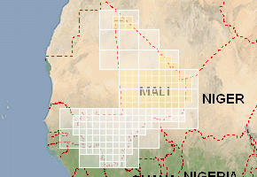
Below the line: various map images and airports with runway lengths.


Airports in MaliClick in the map or on the links listed to view airport web sites. |
|

|
|
| Click here for explanations on technical data | ||||||||
| Town | Airport name | ICAO | IATA | Usage | Customs | Runway | IFR | Rwy length |
| Ansongo | Ansongo | GAAO | Civ. | No | Unpaved | No | 3600 ft | |
| Bafoulabe | Bafoulabe | GABF | Civ. | No | Unpaved | No | 2900 ft | |
| Bamako | Senou | GABS | BKO | Civ. | Yes | Paved | Yes | 8800 ft |
| Bandiagara | Bandiagara | GABD | Civ. | No | Unpaved | No | 2900 ft | |
| Bougouni | Bougouni | GABG | Civ. | No | Unpaved | No | 2900 ft | |
| Bourem | Bourem | GABR | Civ. | No | Unpaved | No | 5000 ft | |
| Douentza | Douentza | GADZ | Civ. | No | Unpaved | No | 2600 ft | |
| Gao | Korogoussou | GAGO | GAQ | Civ. | Yes | Paved | Yes | 8200 ft |
| Goundam | Goundam | GAGM | GUD | Civ. | No | Unpaved | No | 4900 ft |
| Kayes | Kayes | GAKY | KYS | Civ. | Yes | Paved | Yes | 3800 ft |
| Kenieba | Kenieba | GAKA | KNZ | Civ. | No | Unpaved | No | 2900 ft |
| Kidal | Kidal | GAKL | Civ. | No | Unpaved | No | 4500 ft | |
| Kita | Kita | GAKT | Civ. | No | Unpaved | No | 2900 ft | |
| Kolokani | Kolokani | GAKN | Civ. | No | Unpaved | No | 2900 ft | |
| Koutiala | Koutiala | GAKO | KTX | Civ. | No | Unpaved | No | 3900 ft |
| Manantali | Bengassi | Civ. | No | Paved | No | 4900 ft | ||
| Markala | Markala | GAMA | Civ. | No | Unpaved | No | 2900 ft | |
| Menaka | Menaka | GAMK | Civ. | No | Unpaved | No | 3600 ft | |
| Mopti | Barbe | GAMB | MZI | Civ. | Yes | Paved | No | 8200 ft |
| Nara | Keibane | GANK | NRM | Civ. | No | Unpaved | No | 5300 ft |
| Niafunke | Niafunke | GANF | Civ. | No | Unpaved | No | 3900 ft | |
| Nioro | Nioro | GANR | NIX | Civ. | Yes | Paved | No | 4900 ft |
| Sikasso | Sikasso | GASK | KSS | Civ. | No | Unpaved | No | 6200 ft |
| Tessalit | Tessalit | GATS | Civ. | No | Paved | No | 8200 ft | |
| Tombouctou | Tombouctou | GATB | TOM | Civ. | Yes | Paved | No | 4900 ft |
| Yelimane | Yelimane | GAYE | EYL | Civ. | No | Unpaved | No | 5200 ft |


