Posted By Joshua Keating  Wednesday, May 8, 2013 – 3:39 PM
![]() Share
Share
A new paper on the peer-reviewed online journal First Monday summarizes the results of a project to use geographic data gathered from Tweets to create a picture of the world according to Twitter.

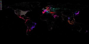
The researches, led by GDELT co-creator Kalev Leetaru, used the Twitter decahose, a massive feed of 10 percent of all tweets, access to which is normally sold at high price to marketers. The project covers the period of the Oct. 23, 2102, to November 30, 2012. During this time, 1,535,929,521 tweets were streamed from 71,273,997 unique users — about 2.8 terabytes worth of data. But only about 3.04 percent of those contained geolocation data — either exact coordinates from mobile phones or user-selected locations. All the same, that's an awful lot of geographical information, and allowed the authors to create this map of a month in the life of Twitter (Bigger, high-resolution version here):
. . . . . . . . .
The plenty more in the paper itself, including list of the world's most retweeted cities. Not surprisingly, New York City is number one, but I was surprised to see that my current hometown, Washington D.C., didn't even crack the top 20, which includes some seemingly unlikely places as Riyadh, Porto Allegre, and San Antonio. Guess we're not the center of the world after all.
Read full article with additional graphics.


