Patrick Meier: Got TweetCred? Use This Tool To Automatically Identify Credible Tweets

Crowd-Sourcing, Geospatial, Innovation, IO Tools, P2P / Panarchy, Politics, Resilience
Patrick Meier
Patrick Meier

Got TweetCred? Use it To Automatically Identify Credible Tweets

What if there were a way to automatically identify credible tweets during major events like disasters? Sounds rather far-fetched, right? Think again.

The new field of Digital Information Forensics is increasingly making use of Big Data analytics and techniques from artificial intelligence like machine learning to automatically verify social media. This is how my QCRI colleague ChaTo et al. already predicted both credible and non-credible tweets generated after the Chile Earthquake (with an accuracy of 86%). Meanwhile, my colleagues Aditi, et al. from IIIT Delhi also used machine learning to automatically rank the credibility of some 35 million tweets generated during a dozen major international events such as the UK Riots and the Libya Crisis. So we teamed up with Aditi et al. to turn those academic findings into TweetCred, a free app that identifies credible tweets automatically.

We’ve just launched the very first version of TweetCred—key word being first. This means that our new app is still experimental. On the plus side, since TweetCred is powered by machine learning, it will become increasingly accurate over time as more users make use of the app and “teach” it the difference between credible and non-credible tweets. Teaching TweetCred is as simple as a click of the mouse. Take the tweet below, for example.

Read full post with more links.

Stephen E. Arnold: New York Public Library Posts Open Maps

Access, Data, Geospatial
Stephen E. Arnold
Stephen E. Arnold

New York Public Library Posts Maps

The New York Public Library has a massive collection of beautiful maps, but instead of keeping them locked in an archive Motherboard reports, “The New York Public Library Releases 20,000 Beautiful High Resolution Maps.”

All of the 20,000 maps are available via open access. What is even more amazing is that the NYPL decided to release the maps under the Creative Commons CCO 1.0 Universal Public Domain Dedication. If you are unfamiliar with a Creative Commons license, it means that users are free to download content and do whatever they want with it.

Continue reading “Stephen E. Arnold: New York Public Library Posts Open Maps”

Stephen E. Arnold: Open Data Collection with Ushahidi

Crowd-Sourcing, Culture, Data, Geospatial, Innovation, Knowledge
Stephen E. Arnold
Stephen E. Arnold

Open Data Collection with Ushahidi

March 28, 2014

The crowdsourced data collection platform Ushahidi, now assisting activists worldwide, was first created to facilitate public accountability and social activism during crises in its home nation, Kenya. Not surprisingly, Ushahidi is also the name of the non-profit behind the open-source project. Open-Steps.org interviewed the organization’s director of data projects, Chris Albon, about the platform. The article prefaces the dialogue with a brief explanation:

“In a nutshell, it allows citizens to make reports in a collaborative way, creating crowdsourced interactive maps. With a very intelligent approach, Ushahidi gives citizens the possibility to use the web, their smartphones and even SMS to gather data, which makes this technology accessible almost everywhere and for everyone. Originally created in Kenya to serve as an instrument for social activism and public accountability in crisis situations, the software has proven to be a great companion worldwide in bringing advocacy campaigns to a successful end. The team behind Ushahidi has not only created a world-changing technology but also they share it with others since it is released as Open Source.”

Albon tells us that the core Ushahidi platform is now being used in 159 countries and has been translated into 35 languages, and explains it is being used by groups from small, election-monitoring non-profits to global organizations tracking disaster relief efforts. Journalists also make use of the platform. Albon notes that his group helped build iHub in Nairobi, an “innovation hub” and community workspace designed to facilitate collaboration and community growth. See the article for more on this and Ushahidi’s other projects, Crowdmap, Swiftriver, Ping, and BRCK. The interview wraps up with something to look forward to: the next generation of the Ushahidi core platform, v3, is on its way.

Cynthia Murrell, March 28, 2014

Sponsored by ArnoldIT.com, developer of Augmentext

Patrick Meier: Humanitarians Using UAVs for Post Disaster Recovery

Drones & UAVs, Geospatial
Patrick Meier
Patrick Meier

Humanitarians Using UAVs for Post Disaster Recovery

I recently connected with senseFly’s Adam Klaptocz who founded the non-profit group DroneAdventures to promote humanitarian uses of UAVs. I first came across Adam’s efforts last year when reading about his good work in Haiti, which demonstrated the unique role that UAV technology & imagery can play in post-disaster contexts. DroneAdventures has also been active in Japan and Peru. In the coming months, the team will also be working on “aerial archeology” projects in Turkey and Egypt. When Adam emailed me last week, he and his team had just returned from yet another flying mission, this time in the Philippines. I’ll be meeting up with Adam in a couple weeks to learn more about their recent adventures. In the meantime, here’s a quick recap of what they were up to in the Philippines this month.

Read full article.

Launching a Search [Eyes] and Rescue [Payload] Challenge for [Mini] Drone / UAV Pilots

Crowd-Sourcing, Drones & UAVs, Geospatial, Innovation
Patrick Meier
Patrick Meier

Launching a Search and Rescue Challenge for Drone / UAV Pilots

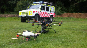
My colleague Timothy Reuter (of AidDroids fame) kindly invited me to co-organize the Drone/UAV Search and Rescue Challenge for the DC Drone User Group. The challenge will take place on May 17th near Marshall in Virginia. The rules for the competition are based on the highly successful Search/Rescue challenge organized by my new colleague Chad with the North Texas Drone User Group. We’ll pretend that a person has gone missing by scattering (over a wide area) various clues such pieces of clothing and personal affects. Competitors will use their UAVs to collect imagery of the area and will have 45 minutes after flying to analyze the imagery for clues.

. . . . . . .

CLick on Image to Enlarge

I want to try something new with this challenge. While previous competitions have focused exclusively on the use of drones/UAVs for the “Search” component of the challenge, I want to introduce the option of also engaging in the “Rescue” part. How? If UAVs identify a missing person, then why not provide that person with immediate assistance while waiting for the Search and Rescue team to arrive on site? The UAV could drop a small and light-weight first aid kit, or small water bottle, or even a small walkie talkie. Enter my new colleague Euan Ramsay who has been working on a UAV payloader solution for Search and Rescue; see the video demo below. Euan, who is based in Switzerland, has very kindly offered to share several payloader units for our UAV challenge. So I’ll be meeting up with him next month to take the units back to DC for the competition.

Read full article.

Patrick Meier: Crisis Mapping without GPS Coordinates

Crowd-Sourcing, Data, Design, Geospatial, Innovation
Patrick Meier
Patrick Meier

Crisis Mapping without GPS Coordinates

I recently spoke with a UK start-up that is doing away with GPS coordinates even though their company focuses on geographic information and maps. The start-up, What3Words, has divided the globe into 57 trillion squares and given each of these 3-by-3 meter areas a unique three-word code. Goodbye long postal addresses and cryptic GPS coordinates. Hello planet.inches.most. The start-up also offers a service called OneWord, which allows you to customize a one-word name for any square. In addition, the company has expanded to other languages such as Spanish, Swedish and Russian. They’re now working on including Arabic, Chinese, Japanese and others by mid-January 2014. Meanwhile, their API lets anyone build new applications that tap their global map of 57 trillion squares.

When I spoke with CEO Chris Sheldrick, he noted that their very first users were emergency response organizations. One group in Australia, for example, is using What3Words as part of their SMS emergency service. “This will let people identify their homes with just three words, ensuring that emergency vehicles can find them as quickly as possible.” Such an approach provides greater accuracy, which is vital in rural areas. “Our ambulances have a terrible time with street addresses, particularly in The Bush.” Moreover, many places in the world have no addresses at all. So What3Words may also be useful for certain ICT4D projects in addition to crisis mapping. The real key to this service is simplicity, i.e., communicating three words over the phone, via SMS/Twitter or email is far easier (and less error prone) than dictating a postal address or a complicated set of GPS coordinates.

Source with Graphics

Patrick Meier: Crisis Mapping in Areas of Limited Statehood

Crowd-Sourcing, Geospatial, Governance
Patrick Meier
Patrick Meier

Crisis Mapping in Areas of Limited Statehood

I had the great pleasure of contributing a chapter to this new book recently published by Oxford University Press: Bits and Atoms: Information and Communication Technology in Areas of Limited Statehood. My chapter addresses the application of crisis mapping to areas of limited statehood, drawing both on theory and hands-on experience. The short introduction to my chapter is provided below to help promote and disseminate the book.

Continue reading “Patrick Meier: Crisis Mapping in Areas of Limited Statehood”