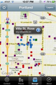
 iPhone App From SimpleGeo Discovers the History, Politics & Wildlife Around You
Geolocation data platform SimpleGeo released its own iOS app this morning to the app store (iTunes link). It clearly points to a future where all the data that's available online about the real-world locations we find ourselves will be available in our hands with the click of a button.

Right now, the app lets you quickly view the boundaries of geographic areas you're in (neighborhood, postal code, congressional district) and it lets you view other layers on top of your map like Wikipedia entries, Flickr photos and Project Noah wildlife sightings. Users with a SimpleGeo Storage account can log-in on the app and then view their own data layers placed on top of the map. That's pretty awesome. Now if only we could share and view each others' layers easily!


