PlanetSAT Global 2020 is available in global, continental, country or custom AOI coverage. Delivery methods include GeoTIFF, JPEG or ECW format. Sample imagery is available upon request.
Phi Beta Iota: East View is **THE** top provider for open source imagery, maps, and charts, including Russian combat charts with contour lines for all the third world locations for which NGA has never gotten around to 1:50,000 production. Strongly recommended. A national asset.
East View Geospatial is excited to announce the launching of our blog, The Geospatial Blog! Every week, we are publishing new posts about the latest & greatest in the geospatial industry. We are eager to share fascinating insights and thought-provoking content for our readers. Although we recently launched, here are a few already-popular posts that we recommend you check out:
The National Geospatial-Intelligence Agency (NGA) Disparate Data Challenge encourages participants to offer solutions that can demonstrate effective capabilities that enable access to data that is wildly disparate in its formats, schemas, interfaces and locations, so that it may be available for search, business metrics and data and information analytics.
Here is our submittal to NGA that was selected within Stage 1 of the competition.
This is the author's preliminary draft of the second of three monographs focused on the future of the US Army as an expeditionary force in a complex world that is rapidly decentralizing while also facing major development challenges. This second monograph (the first presented a notional Grand Strategy for discussion) presents the holistic analytic model and the resulting strategic generalizations from the Marine Corps’ original study, Overview of Planning and Programming Factors for Expeditionary Operations in the Third World (Marine Corps Combat Development Command, March 1990).[1] The model is neither complete nor current – it is a starting point for reflection. A new comprehensive model is needed that supports Grand Strategy not only across the D3 – Defense, Diplomacy, and Development – planning and programming domains, but across Whole of Government (WoG) as well, and ideally, also into the multinational and “eight tribe”[2] conceptual space as well – future operations demand the full integration of both estimative intelligence and operational inclusion of all elements of society, not just government – military.
Please bear in mind that the ISPRS report is not what any one entity has collected or produced, but rather an assessment of collectively what has been produced by all countries worldwide.
Broadly speaking, the 1:50K gaps (not produced by anyone, even the mapping agencies of the respective countries) include:
Flash floods in Beijing have killed over 70 people and forced the evacuation of more than 50,000 after destroying over 8,000 homes and causing $1.6 billion in damages. In total, some 1.5 million people have been affected by the floods after Beijing recorded the heaviest rainfall the city has seen in more than 60 years.
The heavy rains began on July 21. Within hours, users of the Guokr.com social network launched a campaign to create a live crisis map of the flood’s impact using Google Maps. According to TechPresident, “the result was not only more accurate than the government output—it was available almost a day earlier. According to People’s Daily Online, these crowd-sourced maps were widely circulated on Weibo [China's version of Twitter] the Monday and Tuesday after the flooding.” The crowdsourced, citizen-generated flood map of Beijing is available here and looks like this:
I just had the pleasure of speaking with my new colleague Jakob Rogstadius from Madeira Interactive Technologies Institute (Madeira-TTI). Jakob is working on CrisisTracker, a very interesting platform designed to facilitate collaborative social media analysis for disaster response. The rationale for CrisisTracker is the same one behind Ushahidi's SwiftRiver project and could be hugely helpful for crisis mapping projects carried out by the Standby Volunteer Task Force (SBTF).
One of the principal Research and Development (R&D) projects I'm spearheading with colleagues at the Qatar Computing Research Institute (QCRI) has been getting a great response from several key contacts at the UN's Office for the Coordination of Humanitarian Affairs (OCHA). In fact, their input has been instrumental in laying the foundations for our early R&D efforts. I therefore highlighted the initiative during my recent talk at the UN's ECOSOC panel in New York, which was moderated by OCHA Under-Secretary General Valerie Amos. The response there was also very positive. So what's the idea? To develop the foundations for a Twitter Dashboard for the Humanitarian Cluster System.

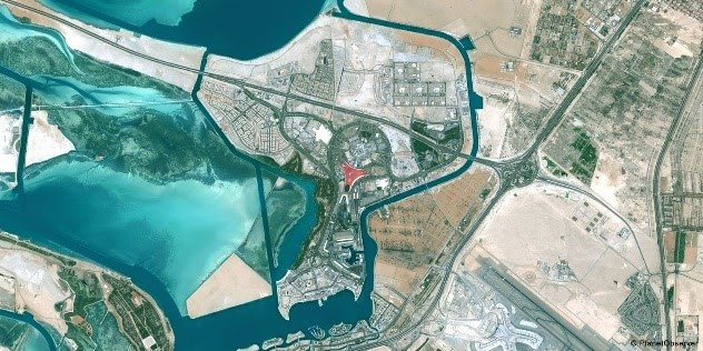 PlanetSAT Global 2020 is available in global, continental, country or custom AOI coverage. Delivery methods include GeoTIFF, JPEG or ECW format. Sample imagery is available upon request.