
Map or Be Mapped: Otherwise You Don’t Exist
“There are hardly any street signs here. There are no official zip codes. No addresses. Just word of mouth” (1). Such is the fate of Brazil’s Mare shanty-town and that of most shantytowns around the world where the spoken word is king (and not necessarily benevolent). “The sprawling complex of slums, along with the rest of Rio de Janerio’s favelas, has hung in a sort of ‘legal invisibility’ since 1937, when a city ordinance ruled that however unsightly, favelas should be kept off maps because they were merely ‘temporary’” (2).
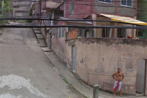
The socio-economic consequences were far-reaching. For decades, this infor-mality meant that “entire neighborhoods did not receive mail. It had also blocked people from giving required information on job applications, getting a bank account or telling the police or fire department where to go in an emergency call. Favela residents had to pick up their mail from their neighborhood associations, and entire slums housing a small town’s worth of residents had to use the zip code of the closest officially recognized street” (3).
All this is starting to change thanks to a grassroots initiative that is surveying Mare’s 16 favelas, home to some 130,000 people. This community-driven project has appropriated the same survey methodology used by the Brazilian government’s Institute of Geography and Statistics. The collected data includes “not only street names but the history of the original smaller favelas that make up the community” (4). This data is then “formatted into pocket guides and distributed gratis to residents. These guides also offer background on certain streets’ namesakes, but leave some blank so that residents can fill them in as Mare […] continues shifting out from the shadows of liminal space to a city with distinct identities” (5). And so, “residents of Rio’s famed favelas are undergoing their first real and ‘fundamental step toward citizenship’” (6).
These bottom-up, counter-mapping efforts are inherently political—call it guerrilla mapping. Traditionally, maps have represented “not just the per-spective of the cartographer herself, but of much larger institutions—of corporations, organizations, and governments” (7). The scale was fixed at one and only one scale, that of the State. Today, informal communities can take matters into their own hands and put themselves on the map; at the scale of their choosing. But companies like Google still have the power to make these communities vanish. In Brazil, Google said it “would tweak the site’s [Google Maps'] design, namely its text size and district labeling to show favela names only after users zoomed in on those areas.”
Continue reading “Patrick Meier: Map or Be Mapped — Psycho-Social Political-Economic Power in a Map”