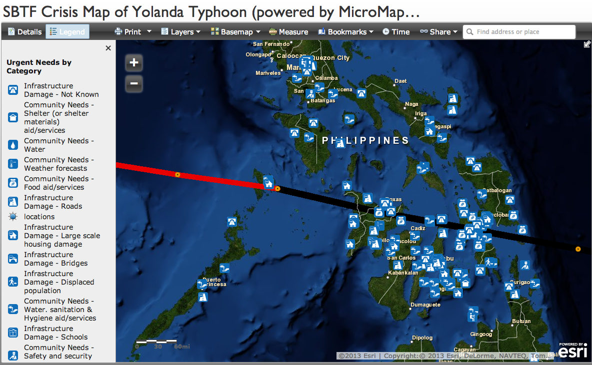
Live Crisis Map of Disaster Damage Reported on Social Media
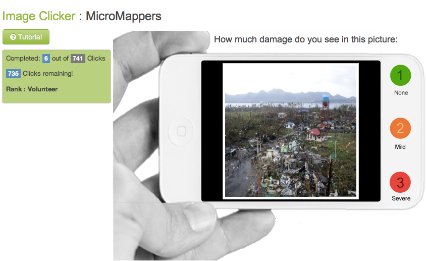
Digital humanitarian volunteers have been busing tagging images posted to social media in the aftermath of Typhoon Yolanda. More specifically, they’ve been using the new MicroMappers ImageClicker to rate the level of damage they see in each image. Thus far, they have clicked over 7,000 images. Those that are tagged as “Mild” and “Severe” damage are then geolocated by members of the Standby Volunteer Task Force (SBTF) who have partnered with GISCorps and ESRI to create this live Crisis Map of the disaster damage tagged using the ImageClicker. The map takes a few second to load, so please be patient.

The more pictures are clicked using the ImageClicker, the more populated this crisis map will become. So please help out if you have a few seconds to spare—that’s really all it takes to click an image. If there are no picture left to click or the system is temporarily offline, then please come back a while later as we’re uploading images around the clock. And feel free to join our list-serve in the meantime if you wish to be notified when humanitarian organizations need your help in the future. No prior experience or training necessary. Anyone who knows how to use a computer mouse can become a digital humanitarian.
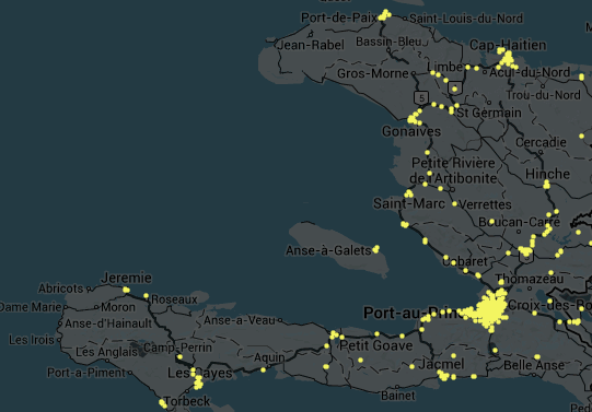
The SBTF, GISCorps and ESRI are members of the Digital Humanitarian Network (DHN), which my colleague Andrej Verity and I co-founded last year. The DHN serves as the official interface for direct collaboration between traditional “brick-and-mortar” humanitarian organizations and highly skilled digital volunteer networks. The SBTF Yolanda Team, spearheaded by my colleague Justine Mackinnon, for example, has also produced this map based on the triangulated results of the TweetClicker:
There’s a lot of hype around the use of new technologies and social media for disaster response. So I want to be clear that our digital humanitarian operations in the Philippines have not been perfect. This means that we’re learning (a lot) by doing (a lot). Such is the nature of innovation. We don’t have the luxury of locking ourselves up in a lab for a year to build the ultimate humanitarian technology platform. This means we have to work extra, extra hard when deploying new platforms during major disasters—because not only do we do our very best to carry out Plan A, but we often have to carry out Plans B and C in parallel just in case Plan A doesn’t pan out. Perhaps Samuel Beckett summed it up best: “Ever tried. Ever failed. No matter. Try Again. Fail again. Fail better.”