Mongoose: Zionists Not Jewish, Fatal to Judaism – Serve Deep State Illuminati

Geospatial, Government

**DO NOT MISS THE #UNRIG TRUTH TOUR! https://bigbatusa.org 15 May to 6 September — EPIC!**

Alert reader writes in:

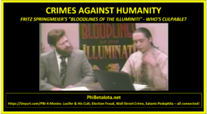
FRITZ SPRIMGMEIER TALKS ABOUT THE TOP “ILLUMINATI” FAMILIES


In this interview, Fritz Springmeier talks about the top “Illuminati” families and how MOST Zionists in the world are NOT EVEN JEWISH:

Click image to go to video

Continue reading “Mongoose: Zionists Not Jewish, Fatal to Judaism – Serve Deep State Illuminati”

Penguin: Open Source Resistance Confronts Private GMS

#OSE Open Source Everything, Geospatial

An open source resistance takes shape as tech giants race to map the world

For Gowda, it was the fact that Google Maps is a global, commercial product and did not capture local detail.

Gowda and a few other contributors from India are part of a tiny yet growing resistance movement which doesn’t want giant corporations to own all the mapping data.

Continue reading “Penguin: Open Source Resistance Confronts Private GMS”

Penguin: Amazon + Waze + Open Source + Muncipalities = Amazon Knows Where Everyone Is, Always

Data, Geospatial

A New Open-Source Framework for Government Projects

More than 600 local, state and federal governments have signed up for the Waze Connected Citizens Program, and more than 80 have expressed interest in a new Waze open source processor—New York City; Los Angeles; Anchorage, Alaska; and Denver among them—to contribute code or deploy the finished solution. The only cost they’ll incur will be that of paying the cloud provider, Amazon, for storage and data transfer: less than $200 a month.

George Por: Silke Helfrich on Mapping as Commons

Geospatial
George Por
George Por

Mapping as Commons

1. Stick to the Commons: as a goal and a practice
2. Create syntony on the goal
3. People’s needs first
4. Keep an eye on interoperability and use web technology
5. Contribute to the Federated Commons
6. Provide open access
7. Use free software
8. Self-host your infrastructure
9. Build on open technology standards
10. Make sure you really own your data
11. Use free open data licenses
12. Guarantee the openness of taxonomies
13. Make the Data Commons thrive through your usage
14. Care for your Data Commons
15. Protect the ‚maps & atlasses commons‘ legally as commons
16. Crowdsource your mapping
17. Remember always why you are making the map and who you are making it for.
18. Archive the map when it doesn’t work anymore for you.

Read full post with expansions for each of the above.

Patrick Meier: Geospatial Information Management – Ten Year Vision

Geospatial
Patrick Meier
Patrick Meier

A 10 Year Vision: Future Trends in Geospatial Information Management

The United Nations Committee of Experts on Global Geospatial Information Management (UN-GGIM) recently published their second edition of Future Trends in Geospatial Information Management. I blogged about the first edition here. Below are some of the excerpts I found interesting or noteworthy. The report itself is a 50-page document (PDF 7.1Mb).

Summary of 22 Critical Points