Patrick Meier: Crowd-Sourcing, AI, and Imagery

Collective Intelligence, Geospatial
Patrick Meier
Patrick Meier

Aerial Imagery Analysis: Combining Crowdsourcing and Artificial Intelligence

MicroMappers combines crowdsourcing and artificial intelligence to make sense of “Big Data” for Social Good. Why artificial intelligence (AI)? Because regular crowdsourcing alone is no match for Big Data. The MicroMappers platform can already be used to crowdsource the search for relevant tweets as well as pictures, videos, text messages, aerial imagery and soon satellite imagery. The next step is therefore to add artificial intelligence to this crowdsourced filtering platform. We have already done this with tweets and SMS. So we’re now turning our attention to aerial and satellite imagery. Read full post with video and links.

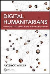
Advance Order (15 Jan 15): Digital Humanitarians: How Big Data is Changing the Face of Humanitarian Response

Advanced Cyber/IO, Crowd-Sourcing, Drones & UAVs, Geospatial, Governance, Innovation, Liberation Technology, Resilience, United Nations & NGOs, Worth A Look
Amazon Page
Amazon Page

This book shows us once again why Patrick Meier is a thought leader in leveraging emerging technologies for social impact. His book captures the enormous possibilities and avoidable pitfalls of big data, social media and artificial intelligence in crisis contexts. Digital humanitarians can be powerful agents for social change but ground-truthing what we see and hear digitally is more important than ever.
—Aleem Walji, Chief Innovation Advisor, Leadership, Learning, and Innovation, World Bank Group

Phi Beta Iota: The book title and description from the publisher are misleading.  This is not a book about Big Data. It is a book about distributed human networks using open source information technologies to achieve situational awareness with a speed and precision that the entire US secret intelligence community (which costs $100 billion a year) cannot match.

See Also:

Patrick Meier @ Phi Beta Iota

Patrick Meier: MicroMappers – Toward Next Generation Humanitarian Technology

Crowd-Sourcing, Geospatial, Innovation
Patrick Meier
Patrick Meier

MicroMappers: Towards Next Generation Humanitarian Technology

The MicroMappers platform has come a long way and still has a ways to go. Our vision for MicroMappers is simple: combine human computing (smart crowd-sourcing) with machine computing (artificial intelligence) to filter, fuse and map a variety of different data types such as text, photo, video and satellite/aerial imagery. To do this, we have created a collection of “Clickers” for MicroMappers. Clickers are simply web-based crowdsourcing apps used to make sense of “Big Data”. The “Text Cicker” is used to filter tweets & SMS’s; “Photo Clicker” to filter photos; “Video Clicker” to filter videos and yes the Satellite & Aerial Clickers to filter both satellite and aerial imagery. These are the “Data Clickers”. We also have a collection of “Geo Clickers” that digital volunteers use to geo-tag tweets, photos and videos filtered by the “Data Clickers”. Note that these “Geo Clickers” automatically display the results of the crowdsourced geo-tagging on our Micro-Maps like the one below.

Continue reading “Patrick Meier: MicroMappers – Toward Next Generation Humanitarian Technology”

Patrick Meier: Digital Jedis, Micro-Mappers, UN, Typhoon Ruby

Crowd-Sourcing, Data, Geospatial
Patrick Meier
Patrick Meier

Calling All Digital Jedis: Support UN Response to Super Typhoon Ruby!

The United Nations has officially activated the Digital Humanitarian Network (DHN) in response to Typhoon Ruby. The DHN serves as the official interface between formal humanitarian organizations and digital volunteer groups from all around the world. These digital volunteers—also known as Digital Jedis— provide humanitarian organizations like the UN and the Red Cross with the “surge” capacity they need to make sense of the “Big Data” that gets generated during disasters. This “Big Data” includes large volumes of social media reports and satellite imagery, for example. And there is a lot of this data being generated right now as a result of Super Typhoon Ruby. To make sense of this flash flood of information, Digital Jedis use crowdsourcing platforms like MicroMappers, which was developed in partnership with the UN Office for the Coordination of Humanitarian Affairs (OCHA).  Read more.

Patrick Meier: Integrating Geo-Data with Social Media Improves Situational Awareness During Disasters

Geospatial
Patrick Meier
Patrick Meier

Integrating Geo-Data with Social Media Improves Situational Awareness During Disasters

A new data-driven study on the flooding of River Elbe in 2013 (one of the most severe floods ever recorded in Germany) shows that geo-data can enhance the process of extracting relevant information from social media during disasters. The authors use “specific geographical features like hydrological data and digital elevation models to prioritize crisis-relevant twitter messages.” The results demonstrate that an “approach based on geographical relations can enhance information extraction from volunteered geographic information,” which is “valuable for both crisis response and preventive flood monitoring.” These conclusions thus support a number of earlier studies that show the added value of data integration. This analysis also confirms several other key assumptions, which are important for crisis computing and disaster response.

Continue reading “Patrick Meier: Integrating Geo-Data with Social Media Improves Situational Awareness During Disasters”

Patrick Meier: Crowdsourced Crisis Map of UAV/Aerial Videos for Disaster Response

Crowd-Sourcing, Drones & UAVs, Geospatial
Patrick Meier
Patrick Meier

Crowdsourced Crisis Map of UAV/Aerial Videos for Disaster Response

The first version of the Humanitarian UAV Network's Crisis Map of UAV/aerial videos is now live on the Network's website. The crowdsourced map features dozens of aerial videos of recent disasters. Like social media, this new medium—user-generated (aerial) content—can be used by humanitarian organizations to complement their damage assessments and thus improve situational awareness.

The purpose of this Humanitarian UAV Network (UAViators) map is not only to provide humanitarian organizations and disaster-affected communities with an online repository of aerial information on disaster damage to augment their situational awareness; this crisis map also serves to raise awareness on how to safely & responsibly use small UAVs for rapid damage assessments. This explains why users who upload new content to the map must confirm that they have read the UAViator‘s Code of Conduct. They also have to confirm that the videos conform to the Network's mission and that they do not violate privacy or copyrights. In sum, the map seeks to crowdsource both aerial footage and critical thinking for the responsible use of UAVs in humanitarian settings.

Read full post with videos.