2002 Lee (US) Geospatial Information Sources: A Global Primer

Geospatial, Historic Contributions
Geospatial Everything

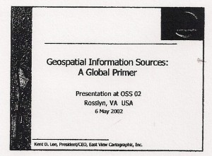
Kent Lee, founder and CEO of both East View Cartographic and East View Everything Else came to our attention in the early 1990's when both USSOCOM and the US Marine Corps were trying to deal with the FACT that the US Government did not have combat charts (tactically useful maps at the 1:50,000 level with contour lines vital to infantry and logistics operations.  We discovered that Russia had focused on the wars of national liberation and did have such maps, and that East View could get them, translate them into English, and deliver them in digital forms suitable for existing US military systems.

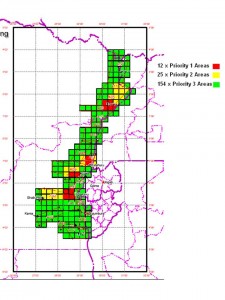
In more recent years, East View has been our primary source of expert access and production assistance in helping United Nations and other forces that suffer from the fact that other than the Russians, every other Western country never put resources into mapping the Third World.  Below left is a color coded depiction of the 175 sheets needed by MajGen Patrick Cammaert, RN NL, then Eastern Force Commander in the Congo.  With Eastview's help, the Dutch government ultimately funded the satisfaction of this urgent need.

Below right is Kent Lee's presentation to OSS '02.
Congo 1:50 Needs
Congo 1:50 Needs
Kent Lee
Kent Lee

2001 Jongman (NL) World Conflict & Human Rights Map

Communities of Practice, Earth Intelligence, Geospatial, Historic Contributions, Threats

PDF of World Conflict Map

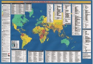
Researcher A.J. Jongman, Interdisciplinary Research Programme (PIOOM), Leiden University, The Netherlands OSS '01: For a brilliant combination of research, insight, and data visualization, in partnership with those associated with the Interdisciplinary Research Programme (PIOOM), resulting in the creation of the World Conflict & Human Rights Map 2000 that portrays so effectively the global conditions of instability that no great nation can ignore.

For many years, this map was the single most popular element of the OSS “Goodie Bag” that grew over time to be a full briefcase with books and such.  We are trying to get ODT Maps to take the map over from the Leiden program and its subsidizer, the Goals for Americas Foundation.  Below is Researcher Jongman's contribution to OSS '01.

Berto Jongman
Berto Jongman

1998 Geographic Information for the 21st Century: Building a Strategy for the Nation

Geospatial, Historic Contributions

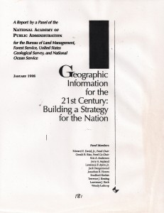
Arnie Donahue, until 1997 the Chief of the C4I Branch in the National Security Division led by Don Gessaman, moved in retirement to the National Academy of Public Administraiton (NAPA) where he continued to engage in investigative surveys at the classified level.  Below is one of the first reports that he helped administer.  It makes the important point that information that is collected, processed, produced, and exploited by both producers and consumers of intelligence cannot be “isolated” into a single agency.  It must be handled as a grid or service of common concern.  This reference was among the first to suggest to us that Open Source Intelligence (OSINT) is a “hybrid” in that is is an intelligence discipline in its own-right, with its own Human, Signals, Imagery, and other sub-components; it is a targeting and validation and contextual sub-element of each of the traditional classified intelligence collection elements (through badly abused and not at all understood by any of them), and finally, it is a consumer-driven source of first resort that has special cachet when shared in a multinational fashion.  Geospatial information is OSINT on steroids–so fundamental across so many boundaries that on the one hand, the reports suggests the need for the inegration of the U.S. Geological Survey and the National Geospaital Agency, while also recognizing that like air and water, geospatial data can be used but not controlled.

Geospatial 21
Geospatial 21

Reference: Mapping Hypertext (1989)

Analysis, Analysis, Augmented Reality, C4/JOE/Software, Collective Intelligence, Geospatial, Historic Contributions, info-graphics/data-visualization, InfoOps (IO), IO Mapping, Journalism/Free-Press/Censorship, Maps, Methods & Process, Monographs, Open Government, Policy, Reform, Research resources, Strategy, Tools
Book Home Page

Title Pages

Chapter 1

Chapter 2

Chapter 3

Chapter 4

Chapter 5

Chapter 6

Chapter 7

Chapter 8

Chapter 9

Appendix

This is the seminal work in what the author has long named “information mapping.”  Posted as a public service with permission of the author, under Creative Commons license.  No commercial exploitation is permitted without documented consent of the author.

Book intended to be read two pages at a time.  The author suggests printing by the chapter, and then reading with even pages to the left and odd pages to the right, two pages at a time.

Visit the author's HOME PAGE.