Worth a Look: CrowdMap (Beta)

Advanced Cyber/IO, Analysis, Augmented Reality, Citizen-Centered, Collective Intelligence, Collective Intelligence, Counter-Oppression/Counter-Dictatorship Practices, Earth Intelligence, Geospatial, Historic Contributions, info-graphics/data-visualization, InfoOps (IO), Intelligence (government), International Aid, IO Mapping, Journalism/Free-Press/Censorship, Maps, Methods & Process, microfinancing, Mobile, Officers Call, Open Government, Policy, Reform, Research resources, Technologies, Tools, Worth A Look

Crowdmap (Liquida)

Crowdmap allows you to…

+ Collect information from cell phones, news and the web.
+ Aggregate that information into a single platform.
+ Visualize it on a map and timeline.

Crowdmap is designed and built by the people behind Ushahidi, a platform that was originally built to crowdsource crisis information. As the platform has evolved, so have its uses. Crowdmap allows you to set up your own deployment of Ushahidi without having to install it on your own web server.

See Also:

Graphics: Twitter as an Intelligence Tool

Reference: How to Use Twitter to Build Intelligence

Journal: Tech ‘has changed foreign policy’

Continue reading “Worth a Look: CrowdMap (Beta)”

U.S. Geological Survey: Twitter Earthquake Detector (TED)

03 Environmental Degradation, 10 Security, Citizen-Centered, Civil Society, Collective Intelligence, Earth Intelligence, Geospatial, Geospatial, Government, Graphics, Media

People can receive earthquake data from the @USGSTED Twitter account. The site sends maps of earthquake zones to account holders.

U.S. Geological Survey: Twitter Earthquake Detector (TED)

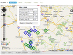
Sample map output from the Twitter Earthquake Detector prototype  project.

The U.S. Geological Survey is using funds from the American Recovery and Reinvestment Act to support a student who’s investigating social Internet technologies as a way to quickly gather information about recent earthquakes.

In this exploratory effort, the USGS is developing a system that gathers real-time, earthquake-related messages from the social networking site Twitter and applies place, time, and key word filtering to gather geo-located accounts of shaking. This approach provides rapid first-impression narratives and, potentially, photos from people at the hazard’s location. The potential for earthquake detection in populated but sparsely seismicly-instrumented regions is also being investigated.

Social Internet technologies are providing the general public with anecdotal earthquake hazard information before scientific information has been published from authoritative sources.  People local to an event are able to publish information via these technologies within seconds of their occurrence. In contrast, depending on the location of the earthquake, scientific alerts can take between 2 to 20 minutes. By adopting and embracing these new technologies, the USGS potentially can augment its earthquake response products and the delivery of hazard information.